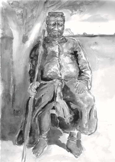
Gungunhana in two Strokes
Abstract
In the second half of the 19th century, the African continent was the scene of territorial disputes by the European powers. Portugal, even though it did not stand out economically in the European context, entered the race. Claiming historical rights, he claimed the territorial extension between the Angolan coast (west coast, on the Atlantic) and the Mozambican coast (east coast, on the Indian Ocean).
In 1884, the Berlin conference was organized, with the aim of defining how the partition of Africa would be carried out. Portugal displayed its claims on a map that became known as the “pink map”: the desired lands were marked with this color. Between Angola and Mozambique was an area that, according to speculation, was rich in minerals and possibly diamonds. It was more than enough to pique English interest. Having before them the strongest of competitors, the most powerful country in the world, the Portuguese had their plans frustrated: they managed to formalize the possession of Angola and Mozambique, however the interior (in the future, Northern Rhodesia and Southern Rhodesia) was England won. Such a decision would be a catastrophe for Portugal. The pink map was the essence of his plans in Africa.

Downloads
Published
How to Cite
Issue
Section
License
Authors who publish in Revista Mouro agree to the following terms:
The. Authors retain copyright and grant Revista Mouro the right to publish.
B. Authors are authorized to assume additional contracts separately, for non-exclusive distribution of the version of the work published in this publication (eg, to publish in an institutional repository or as a book chapter), with acknowledgment of authorship and publication in Revista Mouro.
ç. Authors are allowed and encouraged to publish and distribute their work online (e.g. in institutional repositories or on their personal page) at any point before or during the editorial process, as this can generate productive changes as well as increase impact and the citation of the published work.


